The Entaigo of Usa, Oita Prefecture 掩体壕 宇佐 大分県
Johannes Schonherr – Usa City, Oita Prefecture
Usa City in the northern reaches of Oita Prefecture, Kyushu is most famous for its sprawling Usa Jingu Shrine, dating back to 725 A.D. Usa Jingu is the head shrine to all Hachiman shrines, shrines dedicated to mythical Emperor Ojin, the guardian kami (god) of warriors. It ranks as one of the most important Shinto shrines in Japan.
Famous Usa Jingu receives a large amount of visitors, drawn by its serene lotus ponds, its historical architecture and its religious / cultural significance.
World War II Era Usa Naval Airfield
It’s much less known that during World War II Usa city was not only a place of warship for Hachiman, the God of War, but also the location for a very active base of the Japanese Naval Airforce.
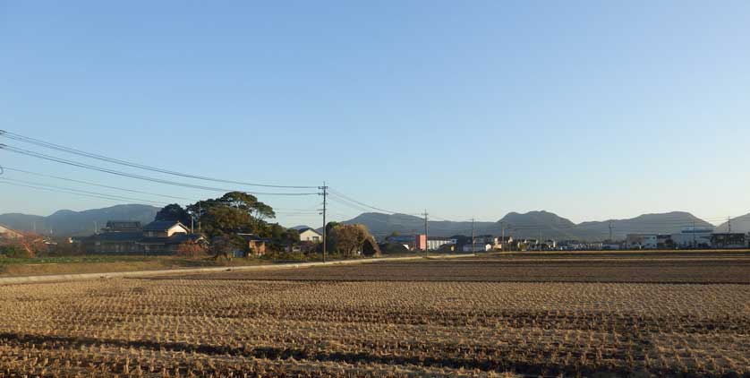
The Yanagigaura section of Usa, a few kilometers northwest of Usa Jingu is perfectly flat, situated between the Oita mountains and the Kanmon Strait separating Kyushu from Honshu, Japan’s main island. The perfect setting for a military air field.
In 1939, the Japanese Naval Airforce acquired a large portion of land in Yanagigaura, formed the Usa Naval Air Corps and built a huge pilot training camp on the former rice paddies.
Kamikaze Pilots
By 1944, Japan was clearly on the losing side of its war against the United States. As a last resort, the tokubetsu kogeki tai (special attack forces) went into operation. In Japanese their name was usually shortened to tokkotai, in the West they are rather known as Kamikaze fighters. Pilots on suicide missions attacking American aircraft carriers and battle ships with small airplanes loaded with bombs. Tokkotai pilots were expected to do their best to destroy their intended targets, sacrificing their own lives in the process.
Those suicide missions took place far south of Usa, in waters around Okinawa. Most pilots went onto their mortal sorties from bases in southern Kyushu like the Ibusuki, Chiran and Kanoya Airfields in Kagoshima Prefecture.
Usa Base
The Usa base was however an important training ground, supplying new pilots for the missions flown from further south. It was also a crucial transfer point for pilots who had received their training much further up north, in Ibaraki Prefecture north of Tokyo for example, and who were now transiting to their final deployment air fields in southern Kyushu.
As a huge base, the Usa Naval Airforce installation soon became a target of American bombers. Air raids killed hundreds of people on the ground. That did not stop the operation of the Usa Airfield though. Operations from there continued until the end of the war in August 1945.
After the war, the air base was dismantled, the airstrips became rice paddies again. But yet, many war time structures remain today. Partly they are overgrown concrete structures, partly they have become clearly visible features of the landscape.
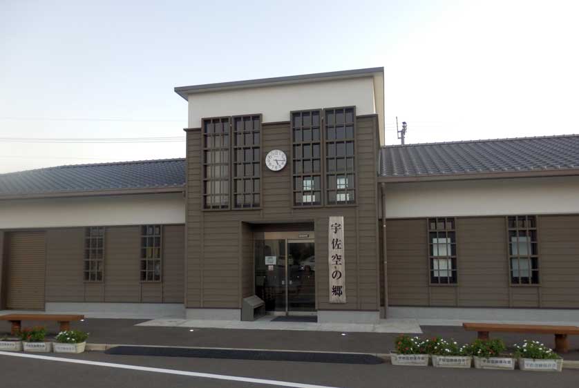
Sora no Sato Museum
The small Sora no Sato (Home of the Sky) museum introduces visitors to the remains of the air base.
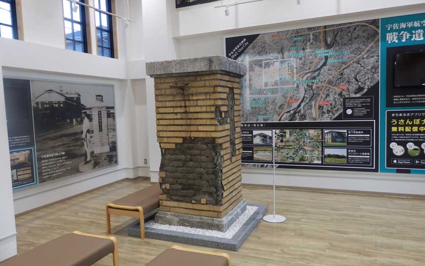
The museum is located right at the old entrance to the former air base. A reconstructed gate post stands outside the museum, the severely battered original gate post forms the main exhibit inside the museum.
WW II era photos of the air base cover the walls, including a large blow-up of an aerial photo taken from an American plane which clearly shows the whole layout of the base as seen from the air. The remains of the air base still extant and visible today are clearly marked.
The Museum staff is very helpful in pointing out the way to those remains. There are various old bunkers and a few surviving buildings to visit.
Usa Entaigo
The main attraction the ols Usa Airbase has to offer, however, is its large number of entaigo, most of them closely clustered. It’s a sight you can’t find anywhere else in Japan.
Entaigo (掩体壕) are bunkers designed to protect and camouflage military aircraft. While there are single entaigo to be found near most of the World War II air fields in southwestern Japan, the large cluster of entaigo in Usa is unique.
The word entaigo itself may have most Japanese scratching their heads. It’s not part of the common language today and probably it never was.
The word Entaigo was a term rather exclusively used by the Japanese army and navy air forces during World II for their airplane bunkers.
Yanagigaura
In the Yanagigaura section of Usa, however, everyone understands the word. There, the old entaigo are part of life.
Walk about one kilometer to the west from the Sora no Sato museum and you will arrive at a road called Flower Road 2. Though all the roads in the area lead right through the center of the old air base, that road has been singled out as a memorial road. Memorial stones line the rural road cutting through the rice fields.
Turn left once you reach Flower Road 2 and follow it up to the sign pointing to the right and spelling out Joiichigo entaigo. Joiichigo entaigo translates to Entaigo #1 of the Joiichi neighborhood.
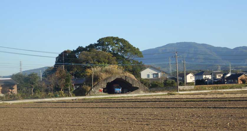
Entaigo #1
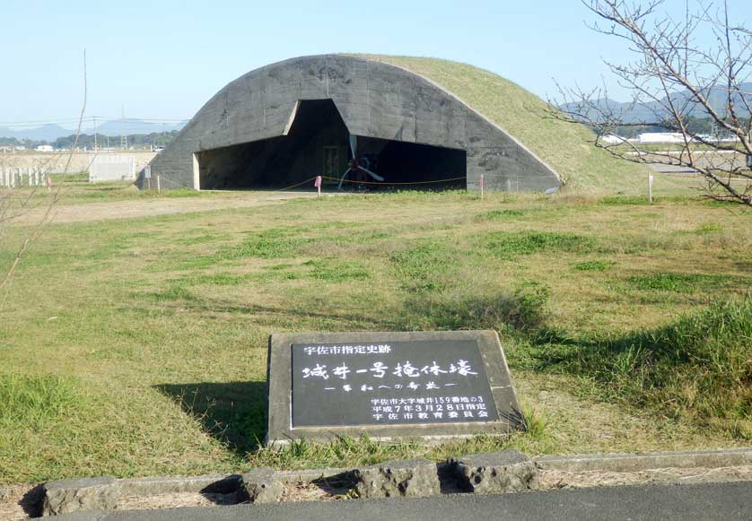
After about 300 meters on, you will arrive at said Entaigo #1. This entaigo, airplane cover bunker, is the best maintained and it serves as a memorial.
The propeller of a WWII era fighter plane has been placed inside the entaigo, giving it (from afar at least) the impression as if it still houses a real plane.
Various memorial stones surround the Entaigo #1. There is a parking lot, there is a public toilet. Visitors are frequent.
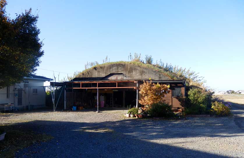
Entaigo Cluster
Looking around, however, you can easily spot two more entaigo in the immediate surroundings.
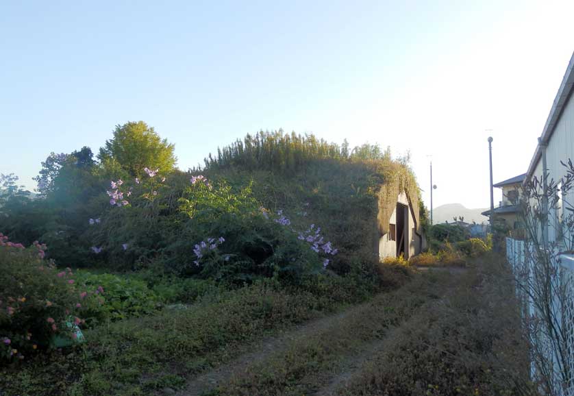
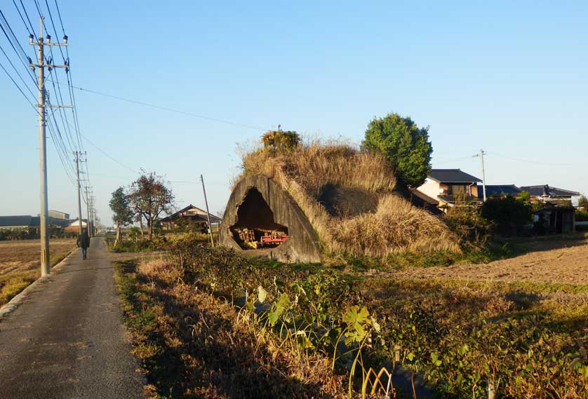
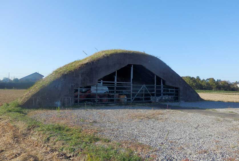
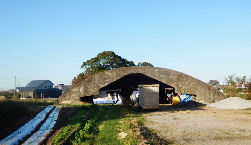
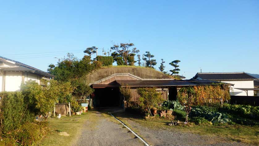
One of them is today used to store agricultural machines. The other one has become part of a rural dwelling and is used by the family living there as a workshop.
At the Entaigo #1, you also find a large wood-framed bicycle tour map. You don’t need to understand any Japanese to figure it out.
The map covers the whole former air base area, suggests various tours through it and clearly marks the ruins and remains still visible with easy to understand drawings.
Just on the opposite side of Flower Road 2, five more entaigo are drawn into the map. They are all in easy walking distance.
New Uses
Those entaigo are all used for peaceful purposes by the local farmers. Some serve as garages for trucks, tractors, harvest combines and the like, others as garden sheds or workshops.
The village they are now part of, has sprung up after the war. The old entaigo became a natural part of it, perfectly blending in.
Not all of those entaigo are easy to find. The villagers are happy to give directions, though, if you ask in Japanese.
While a somewhat somber atmosphere may prevail at the Entaigo #1, those other entaigo have just become part of daily life, the former war fighter bunkers now serving the local population in a perfectly peaceful manner.
Nine such entaigo were marked on the map, I could find eight of them during a leisurely afternoon stroll.
Japan’s largest Entaigo
Still, I have to admit that I have a big regret when thinking back at my visit to the Usa entaigo. I missed the largest of them all, the largest still existing in Japan. At a height of 9 meters, a width of 43 meters and a depth of 23 meters, it was not built for any small kamikaze planes. That one housed a medium-sized bomber made for land attacks.
Those bombers were also used for kamikaze attacks. Not in their bombing capacities, though, but as carriers for tiny Sakurahana (cherry flower) gliders who attacked their targets whithout as much as an engine or propeller. Those bomb-carrying, human steered gliders would hang on the wings of the larger aircraft and be released once the target came into sight.
The large entaigo is about 500 meters north of Entaigo #1. The bicycle tour map clearly marks it.
All I can do for now is linking to the site of a Japanese blogger who took plenty of good shots of that particular entaigo http://www7b.biglobe.ne.jp/~fukuokahatu/usa_chugataentaigou.html
Usa Peace Museum
I had on our trip unfortunately no time to visit the Usa Peace Museum. The Museum displays original tokkotai kamikaze airplanes as well as sakurahana gliders among other wartime artifacts, photos and maps.
The website of Usa city indicates that the Usa Peace Museum is in charge of all memorial and conservational activities regarding the old Usa Naval Air Base.
Access
Usa city is served by the Nippo Main Line, a busy railway line connecting both Hakata Station in Fukuoka and Kokura Station in Kitakyushu with Oita Station. Both Hakata and Kokura Stations are Kyushu Shinkansen stops.
There are frequent buses from Usa Station to Usa Jingu shrine.
Unless you have your own means of transportation (such as a rental car, a motorbike or bicycle), it may be best to use taxis for all other destinations within Usa.
Yanagigaura Station on the Nippo Main Line is closest to both the Sora no Sato Museum and the actual entaigo.
Taxis to both locations are easily available from outside Yanagigaura Station.
Sora no Sato website in Japanese: https://www.city.usa.oita.jp/sougo/soshiki/18/shakaikyoiku/4/usakuunosato/4968.html (auto translation available)
Location: Oaza Esuka, Usa City, 4035, 2nd
Phone: 0978-58-3453
Opening times: Daily from 9am to 5pm, closed on December 31st